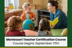
A wooden puzzle map of the world, typically brightly colored and featuring removable continent pieces, serves as a hands-on geography tool in Montessori classrooms. Each continent is often painted a distinct color, allowing children to visually differentiate landmasses. This material complements other globe-related activities, offering a tactile and interactive way for children to learn about Earth’s physical geography.
These maps encourage spatial reasoning, fine motor skill development, and an early understanding of global geography. The process of removing and replacing the pieces helps children internalize the shapes and positions of the continents. This kinesthetic learning approach, central to the Montessori philosophy, fosters independence and a deeper connection to the subject matter. Such materials, often introduced to children aged three and above, provide a foundation for later, more complex geographical studies.
This foundational understanding of continents lays the groundwork for exploring diverse cultures, climates, and ecosystems. By engaging with these tactile maps, children begin a lifelong journey of global awareness and appreciation for the interconnectedness of our world.
Tips for Utilizing Continent Maps in Montessori Education
These tips offer guidance on maximizing the educational value of continent maps within a Montessori learning environment.
Tip 1: Introduce the Map with a Globe: Begin by presenting a globe to establish the Earth’s spherical nature. This helps children understand that the flat map represents a three-dimensional object.
Tip 2: Focus on the Continents, Not Countries: Initially, concentrate on learning the continents’ names, shapes, and relative positions. Detailed country information can be introduced later.
Tip 3: Use the Three-Period Lesson: This classic Montessori technique reinforces learning. First, introduce the name of each continent while pointing to it. Second, ask the child to identify specific continents. Third, encourage the child to name the continents independently.
Tip 4: Encourage Tactile Exploration: Allow children to trace the continents with their fingers, reinforcing the shapes and spatial relationships.
Tip 5: Incorporate Sandpaper Letters: Pair sandpaper letters with the map to reinforce spelling the continents’ names, further connecting visual and tactile learning.
Tip 6: Extend Learning with Related Activities: Use continent maps as a springboard for further exploration, such as researching animals, cultures, or landmarks found on each continent.
Tip 7: Allow for Self-Directed Learning: Encourage children to explore the map independently, fostering their natural curiosity and self-reliance.
By following these tips, educators can effectively utilize continent maps to cultivate geographical awareness and a deeper understanding of the world.
These practical applications of continent maps within a Montessori setting provide a strong foundation for future geographical learning.
1. Hands-on Learning
Hands-on learning forms a cornerstone of Montessori education, particularly in geography studies. Manipulating physical objects allows for a deeper understanding of abstract concepts like global spatial relationships. The Montessori continent map exemplifies this principle, transforming the abstract idea of continents into tangible, interactive learning experiences.
- Tactile Exploration
Tactile exploration encourages a direct sensory experience with the continents. Tracing the wooden pieces, feeling their textures, and fitting them into the puzzle framework allows children to internalize shapes and relative positions. This tactile engagement strengthens memory and comprehension, establishing a firm foundation for subsequent geographical learning.
- Kinesthetic Learning
Kinesthetic learning, through physical movement and manipulation, enhances cognitive processing. The act of picking up, moving, and placing continent pieces promotes active learning, engaging multiple senses and reinforcing spatial understanding. This active participation contrasts sharply with passive observation, leading to more profound and lasting knowledge retention.
- Development of Fine Motor Skills
The precise movements required to manipulate the continent pieces refine fine motor control and hand-eye coordination. Grasping and placing the pieces hones dexterity, supporting future writing and other fine motor tasks. This simultaneous development of cognitive and physical skills demonstrates the integrated nature of Montessori education.
- Concrete Representation of Abstract Concepts
Continents, vast and distant landmasses, can be challenging for young children to grasp. The Montessori continent map provides a concrete representation of these abstract geographical entities. This tangible experience bridges the gap between abstract concepts and concrete understanding, making the world feel more accessible and comprehensible.
Through tactile exploration, kinesthetic engagement, fine motor skill development, and concrete representation, the Montessori continent map facilitates a deeper understanding of global geography. This hands-on approach fosters independent learning and a lasting appreciation for the interconnectedness of our world, crucial elements of the Montessori philosophy.
2. Geographical Awareness
Geographical awareness represents a foundational understanding of the world’s physical and human landscapes. A Montessori continent map serves as a crucial tool for cultivating this awareness in young children. The map provides a concrete representation of Earth’s major landmasses, fostering an early appreciation for global spatial relationships. This initial exposure to continents lays the groundwork for understanding broader geographical concepts such as climate variations, cultural diversity, and interconnected ecosystems. For instance, a child might learn about the African continent through the map and then connect this knowledge to studies of African wildlife or cultural traditions.
This early introduction to global geography has significant practical implications. A geographically aware individual develops a stronger sense of place within the world. Understanding the interconnectedness of global systems fosters informed decision-making, responsible environmental stewardship, and cross-cultural empathy. The continent map acts as a catalyst for this development, sparking curiosity and providing a framework for future learning. It encourages exploration and inquiry, leading children to seek deeper knowledge about the world around them. Furthermore, a solid understanding of geographical principles enhances analytical skills applicable to various fields, from environmental science to international relations.
In summary, the Montessori continent map plays a vital role in nurturing geographical awareness. By providing a hands-on, interactive experience, it facilitates a deeper understanding of global spatial relationships and fosters an appreciation for cultural diversity and interconnected ecosystems. This foundational knowledge equips individuals with essential skills for navigating an increasingly complex and interconnected world. Cultivating geographical awareness through tools like the continent map prepares future generations for informed engagement with global challenges and opportunities.
3. Fine Motor Skills
The Montessori continent map provides a significant opportunity for the development of fine motor skills. Manipulating the individual continent pieces, which are typically designed for easy grasping by small hands, strengthens hand and finger muscles. The precise movements required to lift, place, and rotate the pieces refine hand-eye coordination. This process also enhances dexterity and control, essential for future tasks like writing, drawing, and using tools. The act of fitting the continents into their corresponding slots on the puzzle map further hones these skills, demanding careful placement and adjustments. For instance, fitting the narrow piece representing South America into its designated space requires a higher degree of precision than placing the larger African continent. This nuanced manipulation strengthens the small muscles in the hand and wrist, contributing to overall fine motor development. Moreover, the tactile nature of the wooden material provides sensory feedback, further enhancing motor control and spatial awareness. The varying sizes and shapes of the continents present different challenges, promoting the development of adaptable fine motor skills applicable to a wide range of activities.
The development of fine motor skills through interaction with the continent map extends beyond simply strengthening hand muscles. The process of manipulating the pieces promotes concentration and focus, as children carefully position each continent. This focused engagement contributes to the development of executive functions, including attention span and self-regulation. Furthermore, the successful placement of each continent provides a sense of accomplishment, boosting self-esteem and encouraging further exploration. This positive feedback loop reinforces the importance of fine motor practice and encourages continued engagement with the material. The tactile and kinesthetic nature of the activity makes learning engaging and enjoyable, promoting a positive association with skill development. The integration of fine motor practice with geographical learning highlights the holistic approach of Montessori education.
In summary, the Montessori continent map serves as a valuable tool for developing fine motor skills in young children. The precise movements involved in manipulating the continent pieces strengthen hand muscles, refine hand-eye coordination, and enhance dexterity. This development has significant practical implications for future tasks requiring fine motor control, such as writing and using tools. Furthermore, the engagement with the map fosters concentration, self-regulation, and a sense of accomplishment. This integration of fine motor development with geographical learning underscores the comprehensive nature of Montessori education, fostering both physical and cognitive growth through hands-on exploration.
4. Continental Identification
Continental identification forms a cornerstone of geographical literacy. Within the Montessori context, the continent map provides a crucial tool for fostering this skill. Accurate identification of continents is not merely rote memorization; it represents a fundamental understanding of global spatial organization, laying the groundwork for more complex geographical concepts. This understanding is further enhanced by the tactile and visual nature of the Montessori map, which allows children to internalize the shapes, sizes, and relative positions of the continents.
- Visual Differentiation and Recognition
The distinct colors employed on Montessori continent maps aid in visual differentiation. Each continent, typically painted a unique color, becomes readily identifiable. This color-coding system facilitates visual memory and accelerates the learning process. For example, the bright red of Asia contrasts sharply with the green of South America, allowing children to quickly distinguish between them. This visual clarity promotes efficient learning and reduces cognitive load.
- Nomenclature and Association
Connecting the names of continents to their corresponding shapes is a key element of continental identification. The Montessori approach emphasizes hands-on learning; the act of physically placing each continent piece on the map while simultaneously verbalizing its name reinforces this association. This multi-sensory approach strengthens memory and facilitates accurate recall. Repeated practice with the map solidifies the connection between the visual representation and the name, creating a lasting association.
- Spatial Relationships and Relative Position
Beyond individual identification, the Montessori continent map cultivates an understanding of spatial relationships. Children learn not just the shapes of continents, but also their relative positions to one another. This understanding of spatial organization is fundamental to geographical literacy. For instance, a child learns that Africa is south of Europe and west of Asia. This spatial awareness fosters a more comprehensive understanding of global geography.
- Foundation for Further Geographical Exploration
Mastery of continental identification serves as a springboard for further geographical exploration. Once children can confidently identify continents, they can begin to explore the countries, cultures, and ecosystems within them. This builds upon the foundational knowledge established through the continent map, expanding their understanding of global diversity and interconnectedness. This foundation prepares them for more advanced geographical studies, including topics like climate patterns, biomes, and human migration.
In conclusion, continental identification achieved through interaction with the Montessori continent map is more than simple memorization; it represents a fundamental step in developing geographical literacy. The map’s multi-sensory approach, combining visual, tactile, and kinesthetic learning, facilitates a deeper understanding of global spatial organization. This understanding provides a solid foundation for future geographical exploration, fostering a lifelong appreciation for the interconnectedness of our world. By building this foundation through hands-on experiences, Montessori education prepares children to engage with complex geographical concepts and become informed global citizens.
5. Spatial Reasoning
Spatial reasoning, the ability to visualize and manipulate objects in three dimensions, is significantly developed through interaction with a Montessori continent map. The map, presenting a two-dimensional representation of Earth’s landmasses, requires children to mentally translate this representation into a three-dimensional understanding of the globe. This constant mental translation strengthens spatial thinking skills. The act of placing individual continent pieces within the puzzle framework necessitates an understanding of shape, size, and relative position. For example, a child must visualize how the curved edge of South America fits against the western coast of Africa. This process of fitting pieces together enhances spatial awareness and strengthens the ability to mentally manipulate objects in space. Furthermore, the maps representation of continents as distinct, colored shapes encourages the development of mental maps, internalized representations of spatial relationships. This ability to create and manipulate mental maps is a crucial aspect of spatial reasoning, applicable to navigation, problem-solving, and understanding complex systems.
The development of spatial reasoning through the Montessori continent map has far-reaching implications. Strong spatial skills are linked to success in fields like mathematics, science, and engineering. Spatial reasoning is essential for understanding geometrical concepts, interpreting scientific data, and designing engineering solutions. Furthermore, spatial skills contribute to everyday problem-solving, from navigating a new environment to packing a suitcase efficiently. The hands-on experience provided by the continent map lays a strong foundation for these future applications. For instance, a child who has developed strong spatial skills through map work may find it easier to learn complex geometric proofs or interpret three-dimensional models in science class. The map serves as a concrete tool for abstract thought, bridging the gap between the tangible and the conceptual.
In conclusion, the Montessori continent map provides a valuable opportunity to cultivate spatial reasoning skills. The manipulation of physical map pieces strengthens the ability to visualize and manipulate objects in three dimensions. This skillset is essential for success in various academic disciplines and contributes to practical problem-solving in everyday life. The maps tangible nature provides a concrete foundation for abstract thought, preparing children for more complex spatial challenges and fostering a deeper understanding of the world around them.
Frequently Asked Questions
This section addresses common inquiries regarding the use and benefits of Montessori continent maps in educational settings.
Question 1: At what age are Montessori continent maps typically introduced?
Continent maps are often introduced around age three, but the appropriate time depends on the child’s developmental readiness and interest.
Question 2: How do continent maps differ from traditional world maps?
Continent maps emphasize the shapes and relative positions of continents, simplifying the world map to focus on these key landmasses. Traditional maps may include intricate details like countries, borders, and topographical features, which can overwhelm young learners.
Question 3: How can a continent map enhance a child’s understanding of geography?
The interactive nature of the map allows children to physically manipulate the continents, fostering a deeper understanding of their shapes, sizes, and positions relative to each other. This kinesthetic learning experience lays a foundation for future geographical studies.
Question 4: What are the key benefits of using a continent map in a Montessori environment?
Key benefits include improved fine motor skills, enhanced spatial reasoning, increased geographical awareness, and the development of problem-solving abilities through puzzle-solving. The map also fosters independence and self-directed learning.
Question 5: Are there recommended activities to use in conjunction with a continent map?
Recommended activities include using sandpaper letters to spell continent names, researching animals or cultures native to each continent, and incorporating related materials like globes or small flags to represent different countries. These activities provide a multi-faceted learning experience, expanding upon the basic geographical knowledge offered by the map itself.
Question 6: How can parents incorporate continent maps into learning at home?
Parents can engage children in interactive play with the map, asking them to identify continents, place them correctly, and discuss their characteristics. They can also extend learning through books, stories, and online resources related to different continents, fostering curiosity and a deeper understanding of the world.
Understanding the purpose and benefits of Montessori continent maps ensures effective utilization within the educational framework.
Conclusion
This exploration of Montessori continent maps has highlighted their significance as foundational learning tools within the Montessori educational approach. Their multifaceted nature fosters not only geographical awareness but also the development of fine motor skills, spatial reasoning, and problem-solving abilities. The hands-on, interactive experience offered by these maps encourages children to engage actively with global geography, laying the groundwork for a more comprehensive understanding of the world and its diverse cultures and ecosystems. The simplicity of the map design, focusing on continental shapes and positions, allows young learners to grasp fundamental geographical concepts without being overwhelmed by excessive detail. The integration of tactile and visual learning reinforces knowledge retention and promotes a deeper connection to the subject matter.
The benefits of incorporating Montessori continent maps extend beyond immediate educational goals. Cultivating spatial reasoning and geographical awareness from an early age equips individuals with valuable skills applicable to various fields of study and life experiences. These skills contribute to critical thinking, problem-solving, and an appreciation for the interconnectedness of global systems. Encouraging interaction with these tactile learning tools fosters a lifelong curiosity about the world and empowers individuals to become informed and engaged global citizens. Further research and observation within Montessori classrooms can provide valuable insights into the long-term impact of these educational tools on cognitive and social development.


