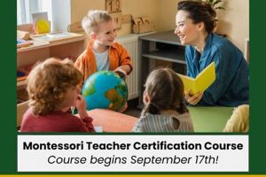
Puzzle maps, often wooden and featuring brightly colored continents, are frequently employed in Montessori classrooms to introduce geography. These materials allow children to kinesthetically explore the worlds landmasses, developing spatial reasoning skills by assembling and disassembling them. A typical example might depict the continents, sometimes with additional details such as countries or major bodies of water.
These learning tools provide a hands-on approach to geography education, fostering independence and a deeper understanding of global interconnectedness. By manipulating the individual pieces, children internalize the shapes and relative positions of continents, oceans, and other geographical features. This tactile experience lays a foundation for more advanced geographical studies, cultivating a sense of place within the larger world. Historically, this approach aligns with Maria Montessori’s emphasis on sensory learning and self-directed exploration.
This exploration of geographical tools and their application within a Montessori learning environment will further delve into specific types of maps, their usage in various age groups, and the broader educational philosophy supporting their implementation.
Tips for Utilizing Continental Puzzle Maps
These tips offer guidance on maximizing the educational benefits of continental puzzle maps for children.
Tip 1: Start with the Basics: Begin with a simple puzzle map featuring only continents. Once familiarity develops, introduce more complex maps showing countries, states, or other geographical features.
Tip 2: Encourage Exploration: Allow children to manipulate the pieces freely, exploring the shapes and relationships between landmasses without pressure. Self-discovery is key.
Tip 3: Incorporate Storytelling: Enhance learning by connecting geographical features to stories, cultures, or animals associated with specific regions.
Tip 4: Use Supplementary Materials: Combine the puzzle map with globes, books, or other resources to broaden understanding and create a multi-faceted learning experience.
Tip 5: Introduce Nomenclature: Gradually introduce the names of continents and other geographical features as children become more comfortable with the puzzle map.
Tip 6: Promote Control of Error: The self-correcting nature of puzzle maps allows children to identify and rectify errors independently, fostering problem-solving skills.
Tip 7: Extend Learning Through Activities: Consider related activities such as labeling continents, researching different cultures, or creating artwork inspired by specific locations.
Through these strategies, puzzle maps can serve as a valuable tool for cultivating geographical awareness and promoting a love of learning about the world.
These tips offer a starting point for educators and parents seeking to integrate these tools into a child’s learning journey. Further exploration of specific applications and related materials can enrich the educational experience even more.
1. Hands-on Learning
Hands-on learning forms a cornerstone of the Montessori educational approach, and its application to geographical exploration through puzzle maps offers a powerful example. Manipulating tangible map pieces allows children to internalize abstract geographical concepts in a concrete way. This tactile engagement fosters a deeper understanding of spatial relationships, the relative sizes of landmasses, and the interconnectedness of global regions. Instead of passively observing a flat representation, children actively construct and deconstruct the world, fostering a sense of ownership and agency in the learning process. For example, a child assembling a puzzle map of the world not only learns the shapes and positions of the continents but also develops a kinesthetic understanding of their relationships to one another.
This active learning process goes beyond simple memorization. The act of fitting continents together requires problem-solving skills and promotes concentration. The self-correcting nature of the puzzles allows children to identify and rectify their own mistakes without external intervention, fostering independence and self-reliance. Further, the tactile nature of the materials caters to diverse learning styles, providing an alternative entry point for children who may not respond as readily to traditional textbook-based instruction. The three-dimensional aspect of some puzzle maps also provides a more realistic representation of the Earth’s curvature compared to flat maps, laying the groundwork for understanding globes and projections.
The emphasis on hands-on learning through puzzle maps provides a foundation for more complex geographical concepts. This initial tactile experience can be a springboard for exploring topography, climate, culture, and the interconnectedness of global systems. Challenges may include ensuring access to high-quality materials and providing adequate time for exploration. However, the benefits of this approach, in terms of deeper understanding, increased engagement, and the development of critical thinking skills, make it a valuable component of a well-rounded Montessori education.
2. Geographical Awareness
Geographical awareness represents a foundational understanding of the world’s physical and human landscapes. Within a Montessori context, puzzle maps serve as a key tool for cultivating this awareness, providing a concrete, interactive introduction to global geography.
- Spatial Relationships
Puzzle maps allow children to visualize and internalize the spatial relationships between continents, oceans, and other geographical features. The act of fitting the pieces together develops an understanding of relative size and position. For example, a child working with a puzzle map can grasp that Africa is south of Europe and east of South America, developing a sense of global interconnectedness. This foundational knowledge provides a framework for understanding more complex geographical concepts such as latitude, longitude, and time zones.
- Land and Water Forms
The tactile nature of puzzle maps helps children differentiate between landmasses and bodies of water. The varied shapes and textures of the puzzle pieces reinforce the distinction between continents and oceans. The physical act of assembling the puzzle reinforces the concept of Earth’s division into land and water, a fundamental aspect of geographical understanding. This can be further expanded upon by introducing landform vocabulary like mountains, valleys, and plains, and by discussing the different types of water bodies, like seas, rivers, and lakes.
- Cultural Diversity
While primarily focused on physical geography, puzzle maps can also serve as a springboard for exploring cultural diversity. By associating continents with different cultures, languages, or animals, children begin to understand the human element of geography. For example, discussing African wildlife while assembling the African continent piece connects the physical location with its unique inhabitants. This integration of physical and human geography lays the foundation for exploring complex topics like migration, trade, and cultural exchange.
- Environmental Consciousness
The interconnected nature of geographical features, as represented in puzzle maps, can subtly introduce environmental consciousness. Children begin to understand that actions in one part of the world can have consequences elsewhere. Discussions about climate change or pollution can be initiated by referencing the interconnectedness of oceans or the shared atmosphere represented on the map. This fosters a sense of global citizenship and responsibility towards the environment.
These interconnected facets of geographical awareness, nurtured through the use of puzzle maps, contribute to a holistic understanding of the world. By providing a concrete, interactive learning experience, puzzle maps lay a strong foundation for future geographical studies and cultivate an appreciation for the interconnectedness of global systems. Further exploration might involve using globes, detailed maps, and research projects to delve deeper into specific regions, climates, and cultures.
3. Sensory Exploration
Sensory exploration plays a crucial role in a Montessori education, particularly in the context of geography and the use of puzzle maps. These maps offer a rich sensory experience that enhances a child’s understanding of the world. Tactile manipulation, visual observation, and even auditory input contribute to a more comprehensive and engaging learning process.
- Tactile Input
The textured surfaces of wooden puzzle maps provide a tactile experience that allows children to differentiate between land and water, grasp the varying shapes of continents, and develop fine motor skills through manipulation of the pieces. The act of tracing the outlines of continents with their fingers enhances spatial understanding and memory. For example, the rough texture of a wooden continent piece contrasts with the smooth surface of the surrounding ocean, reinforcing the distinction between these geographical features.
- Visual Stimulation
Brightly colored maps enhance visual engagement and aid in memory retention. Distinct colors for each continent help children differentiate and identify them more readily. The visual representation of landmasses and bodies of water supports the development of spatial reasoning skills. For instance, the clear visual boundaries between colored continents on a puzzle map help children internalize the concept of separate landmasses.
- Auditory Reinforcement
While puzzle maps themselves are primarily visual and tactile, auditory learning can be incorporated through activities such as naming continents aloud while placing them on the map, listening to stories or music related to specific regions, or discussing different cultures and languages associated with geographical areas. This multi-sensory approach strengthens learning and caters to diverse learning styles.
- Kinesthetic Learning
The act of physically manipulating puzzle pieces promotes kinesthetic learning. Children learn by doing, internalizing geographical concepts through the physical process of assembling and disassembling the map. This active engagement reinforces learning and fosters a deeper understanding of spatial relationships. For example, rotating and fitting a continent piece into its correct position on the puzzle map helps children internalize its shape and location relative to other landmasses.
These combined sensory inputs foster a deeper understanding of geography than traditional, visually-dominant methods. The multi-sensory engagement provided by puzzle maps makes learning more engaging and memorable, laying a strong foundation for future geographical studies. Furthermore, this approach aligns with the broader Montessori philosophy of providing children with concrete, manipulative materials to explore abstract concepts, fostering independence and self-directed learning.
4. Fine Motor Skills
Development of fine motor skills is an integral part of early childhood education, and Montessori puzzle maps provide a unique avenue for enhancing these skills within a geographical context. Manipulating the individual pieces of these maps requires precise movements, strengthening hand-eye coordination and dexterity, abilities essential for writing, drawing, and other practical life activities.
- Grasping and Placing
The act of grasping and placing puzzle pieces necessitates precise hand movements, refining a child’s ability to control small objects. Picking up individual continents and positioning them correctly on the map strengthens the pincer grasp, crucial for future tasks like holding a pencil or using utensils. The varying sizes and shapes of the pieces offer diverse challenges, further refining dexterity.
- Rotation and Manipulation
Correctly positioning puzzle pieces often requires rotating and manipulating them within the hand. This strengthens wrist rotation and hand-eye coordination as the child visually assesses the piece and adjusts its orientation to fit. These movements contribute to developing the fluidity and precision necessary for activities like writing and using tools.
- Problem-Solving through Manipulation
The puzzle aspect of the maps introduces a problem-solving element that further enhances fine motor development. Children must analyze the shapes of the pieces and the available space on the map, using their hands to test different positions until they find the correct fit. This process reinforces spatial reasoning and problem-solving skills alongside fine motor control.
- Bilateral Coordination
Working with puzzle maps often involves using both hands simultaneously one to hold the map and the other to manipulate the pieces. This promotes bilateral coordination, the ability to use both hands together in a coordinated manner. This skill is essential for tasks such as tying shoes, cutting with scissors, and playing musical instruments.
The development of fine motor skills through the use of Montessori puzzle maps provides a foundation for future academic and practical life activities. By integrating these skills into a geographically relevant context, children not only improve their dexterity and coordination but also develop a deeper understanding of the world around them. This connection between physical manipulation and cognitive learning exemplifies the holistic approach of Montessori education.
5. Cultural Understanding
Cultural understanding represents a crucial aspect of global citizenship, and Montessori maps, while primarily geographical tools, offer a starting point for fostering this understanding. These maps provide a framework for exploring the diverse cultures inhabiting different regions of the world, connecting geographical location with human experience.
- Connecting People and Place
Montessori maps provide a visual representation of the world, allowing children to associate specific locations with different cultures. By linking continents and countries with information about their people, traditions, and languages, educators can introduce the concept of cultural diversity. For example, placing miniature figurines representing different ethnicities or traditional clothing on the map can visually connect geographical location with cultural representation. This helps children grasp the concept that different parts of the world are home to diverse groups of people.
- Exploring Traditions and Customs
Using the map as a reference point, educators can introduce stories, music, or art from different cultures. This allows children to experience cultural expressions firsthand, developing an appreciation for the richness and diversity of human experience. For example, listening to traditional music from Africa while exploring the African continent on the map creates a multi-sensory learning experience that connects place with cultural expression. This can also be achieved through exploring traditional crafts, clothing, or culinary practices associated with specific regions.
- Understanding Global Interconnectedness
Montessori maps can also be used to explore historical and contemporary relationships between cultures. Discussions about trade routes, migration patterns, or cultural exchange can help children understand the interconnectedness of human societies. This can lead to discussions about global issues and shared challenges, fostering empathy and a sense of global citizenship. For example, tracing historical trade routes on the map can illustrate how cultures have interacted and influenced each other throughout history.
- Challenging Stereotypes
By providing accurate and nuanced representations of different cultures, Montessori maps can challenge stereotypes and promote respect for diversity. Educators can use this opportunity to discuss the dangers of oversimplification and the importance of understanding cultural nuances. This promotes critical thinking and helps children develop a more informed and empathetic perspective on the world. For example, highlighting the diversity within a single continent can challenge the notion of homogenous cultures and encourage children to appreciate the complexities of human societies.
By connecting geographical location with cultural exploration, Montessori maps serve as a springboard for developing cultural understanding and global citizenship. These early experiences lay a foundation for future intercultural learning, promoting tolerance, respect, and an appreciation for the rich tapestry of human experience. Further exploration could involve researching specific cultures, engaging with diverse communities, and participating in cross-cultural exchanges, fostering a deeper understanding of global interconnectedness.
6. Self-Correction
Self-correction, a cornerstone of Montessori philosophy, finds practical application in the use of Montessori maps. These maps, often presented as puzzles, inherently facilitate self-correction, fostering independent learning and problem-solving skills in children. This aspect contributes significantly to the efficacy of these materials in geographical education.
- Inherent Design
The design of Montessori puzzle maps, with their unique shapes and interlocking pieces, provides an immediate and tangible feedback mechanism. Each continent or country piece fits only in its designated place, allowing children to recognize and rectify placement errors independently. This built-in control of error eliminates the need for constant adult intervention, fostering self-reliance and confidence.
- Development of Problem-Solving Skills
When a piece doesn’t fit, children are prompted to analyze the shape, orientation, and surrounding pieces, developing problem-solving skills. This process encourages them to try different approaches, evaluate their effectiveness, and adjust their strategy until the correct placement is achieved. This active problem-solving contributes to cognitive development and reinforces spatial reasoning.
- Promoting Independence and Confidence
The self-corrective nature of the maps promotes independent learning. Children can explore and learn at their own pace, free from the pressure of external judgment or correction. Successfully placing the pieces reinforces their understanding and builds confidence in their ability to learn independently.
- Internalization of Geographical Knowledge
Through repeated self-correction, children internalize geographical information more effectively. The process of manipulating the pieces, recognizing errors, and finding the correct placement reinforces spatial relationships and the relative positions of continents and countries. This active learning process leads to a deeper and more lasting understanding of geographical concepts.
The self-correcting aspect of Montessori maps contributes significantly to their educational value. By fostering independent learning, problem-solving skills, and confidence, these maps empower children to explore and understand the world around them in a meaningful and engaging way. This feature aligns seamlessly with the broader Montessori philosophy of self-directed learning and the development of intrinsic motivation.
7. Concrete to Abstract
The progression from concrete to abstract learning forms a core principle of Montessori education, exemplified by the use of maps. These provide a tangible, manipulative representation of the abstract concept of geographical location. Children begin by interacting with the concrete materialsthe puzzle pieces representing continents or countries. Through tactile exploration and manipulation, they internalize the shapes, sizes, and relative positions of these landmasses. This concrete experience forms the foundation for understanding more abstract geographical concepts such as latitude, longitude, and the interconnectedness of global systems. For example, a child initially learns about continents by manipulating puzzle pieces. Later, this concrete experience translates into an understanding of continents as vast landmasses with diverse ecosystems and cultures, a more abstract concept. This progression fosters a deeper, more meaningful understanding of geography than traditional rote memorization.
This concrete-to-abstract approach extends beyond simply learning geographical locations. The process of assembling the puzzle map encourages problem-solving skills as children manipulate the pieces to find the correct fit. This concrete action translates into abstract thinking skills such as spatial reasoning and logical deduction. Further, the self-correcting nature of the puzzles promotes independent learning and error analysis. Children learn to identify and correct their own mistakes without external intervention, fostering self-reliance and a growth mindset. This concrete experience of self-correction translates into the abstract ability to evaluate one’s own work and learn from mistakes, a skill applicable across various disciplines. The use of supplementary materials, like globes or books, alongside the puzzle maps, further reinforces this transition, bridging the gap between concrete manipulation and abstract representation.
Understanding the concrete-to-abstract progression inherent in the use of Montessori maps is crucial for educators and parents. This approach facilitates deeper understanding, promotes problem-solving skills, and fosters independent learning. While challenges may include access to high-quality materials and the need for careful observation and guidance, the benefits of this approach contribute significantly to a child’s cognitive development and their understanding of the world. This principle extends beyond geography, serving as a fundamental element of Montessori education across various subject areas. Ultimately, it equips children with the skills and understanding necessary to navigate an increasingly complex and interconnected world.
Frequently Asked Questions
This section addresses common inquiries regarding the use and benefits of Montessori maps in educational settings.
Question 1: What age is appropriate for introducing Montessori maps?
Children as young as three can benefit from introductory map materials like continent puzzles. Complexity increases gradually with age, introducing more detailed maps featuring countries, states, and other geographical features as the child’s understanding develops.
Question 2: How do Montessori maps differ from traditional maps?
Montessori maps emphasize hands-on learning and self-discovery. Puzzle maps, often made of wood with textured surfaces, encourage tactile exploration, while traditional maps are typically two-dimensional representations. This hands-on approach promotes deeper understanding and engagement.
Question 3: What are the key benefits of using Montessori maps?
Benefits include improved fine motor skills through piece manipulation, enhanced geographical awareness and spatial reasoning, and fostering independence through self-correction. These maps also serve as a platform for cultural exploration and understanding.
Question 4: How can Montessori maps be integrated with other learning materials?
Integration with globes, books, research projects, and cultural artifacts enriches the learning experience. Globes offer a three-dimensional perspective, while books and research projects provide deeper insights into specific regions and cultures.
Question 5: Are Montessori maps only beneficial for geography lessons?
While primarily used for geography, these maps can also enhance language development through discussions about different countries and cultures, and mathematics through activities involving scale and measurement. They also contribute to fine motor skills development.
Question 6: Where can high-quality Montessori maps be purchased?
Reputable Montessori educational supply stores, both online and physical, are the recommended sources for these specialized materials. Prioritizing quality ensures durability and accurate geographical representation.
Understanding these key aspects of Montessori maps can facilitate their effective implementation, maximizing their educational benefits for children.
The following section explores practical applications of Montessori maps within the classroom setting and provides examples of engaging activities.
Conclusion
Exploration of Montessori maps reveals their significant contribution to a child’s holistic development. From concrete manipulation of puzzle pieces to abstract understanding of global interconnectedness, these tools foster geographical awareness, fine motor skills, and cultural understanding. The self-correcting nature of these materials promotes independent learning and problem-solving, aligning with core Montessori principles. The progression from tactile exploration to conceptual understanding underscores the efficacy of these maps in bridging concrete and abstract learning.
The potential of Montessori maps extends beyond geographical knowledge, offering opportunities for interdisciplinary learning and cultivating a lifelong appreciation for the interconnected world. Continued research and innovative applications of these materials promise to further enrich educational practices and empower future generations with a deeper understanding of their place in the world.


